The outdoors is getting crowded -- trails I used to love now require permits. Parks that used to be quiet now require overflow parking.
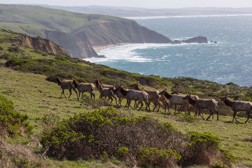
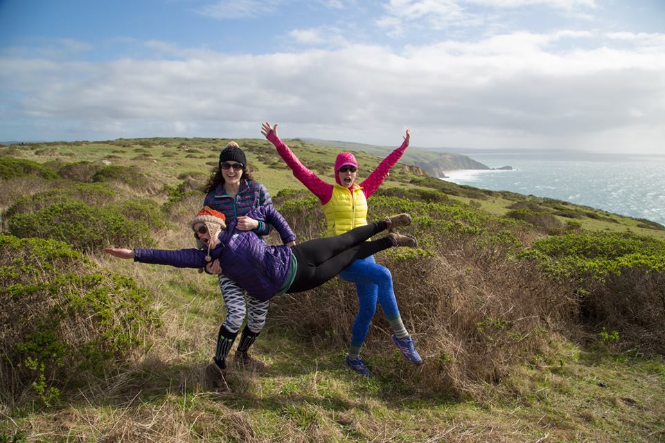
But that doesn't mean you need to travel far from San Francisco to see herds of elk and other wildlife in their natural habitat... and maybe even escape some of the crowds. Some. Not all. You probably won't hear the other visitors, though -- the wind is likely to drown them out. Yes. The Tomales Point/Pierce Point Trail is a very windy hike. Wind can be exhausting and uncomfortable, but if you dress appropriately, you can still have a wonderful time. (See also: Why Women Are ALWAYS Colder Than Men.) What to wear: When I hiked it, it was 55°F, mostly sunny to scattered clouds, and the winds ranged from 18-24 miles per hour. I wore a pair of leggings/yoga pants, a long sleeve dry-fit shirt, a hooded Northface Thermoball (with the hood up the entire time -- it kept the wind off my neck, and held my baseball hat in place), and a down vest. Typically, I say that if you're not a little too cold when you start hiking, you'll be too hot within ten minutes. That was not true on this hike. I was comfortable when I started, but I never removed a single layer. (A girl that I was hiking with had a pair of hiking pants on over her leggings, and she ended up removing them about a mile into the hike.) Dress in layers so you can adjust accordingly. 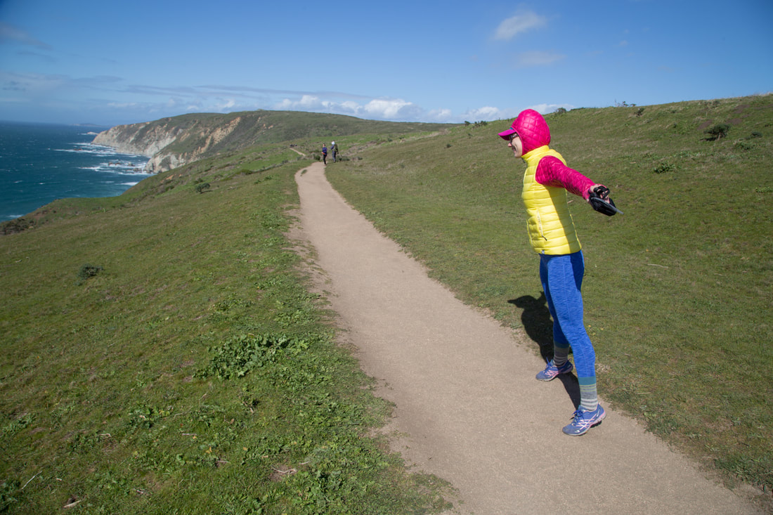
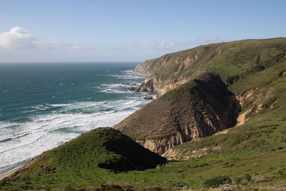
How long is the hike? The hike can pretty much be as long as you want it to be -- you don't have to walk more than a mile on one direction to get stunning views and see elk, birds, wildflowers, and maybe even whales along stunning coastline (though the most popular hikes for whale viewing are Chimney Rock and Point Reyes Lighthouse, and accessing them during the winter migration requires taking a shuttle from the Kenneth C. Patrick Visitor Center, $). Hiking along the narrow peninsula, you will see views of Tomales Bay and Bolinas Ridge to the east, Bodega Bay to the north, and the Point Reyes peninsula to the south. If you're feeling ambitious, the one-way trail is about 4.8 miles, making the entire trek about 9.7 miles. 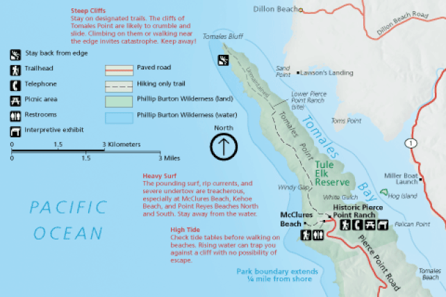
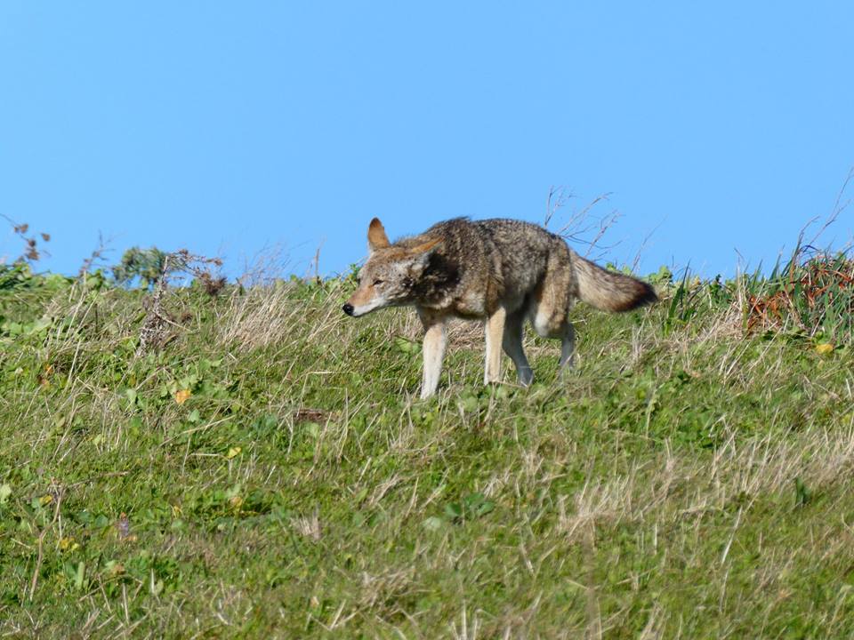
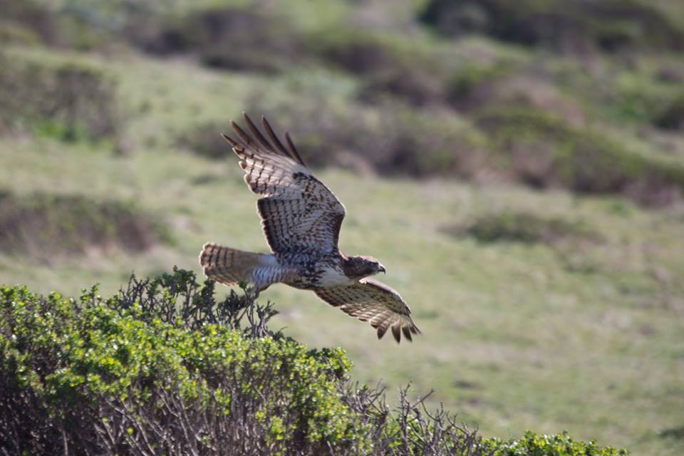
How to get there: The trailhead is located at the northern end of Point Reyes National Seashore. Park at the historic Pierce Point Ranch, where you can glimpse into the early dairy ranching days on the peninsula. From the Bear Valley Visitor Center, drive northwest about 2 miles on Bear Valley Road, then turn left on Sir Francis Drake Boulevard. After driving another 5.6 miles, turn right at the Y signed for "Tomales Bay State Park" and "Pierce Point Ranch." Follow Pierce Point Road 9 miles to Pierce Point Ranch and park. From there, you can't miss the Tomales Point Trailhead. Sir Francis Drake Boulevard and Pierce Point Road are windy and slow-going, and you may get stuck behind a slow vehicle -- so allow about 35 minutes for the 16.6-mile drive from the Bear Valley/Olema/Point Reyes Station area to the Tomales Point parking lot. The Point Reyes website suggests allowing one hour and 35 minutes for the drive from the Santa Rosa area, northwest San Francisco, or the northern East Bay. Keep your eyes open for coyotes, migratory birds, hawks, and wildflowers! 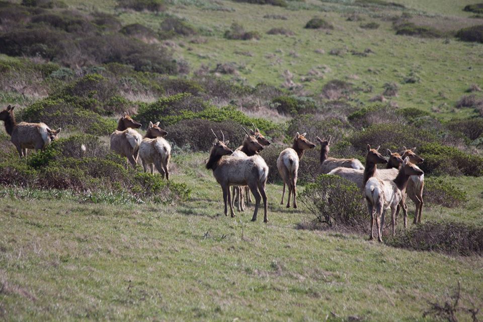
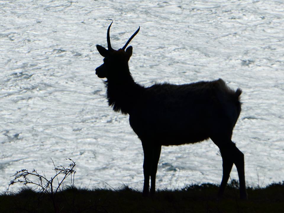
Also note: The closest gas station is 16 miles away, in Point Reyes Station. Check the weather first. It will probably be windy, but it might also be super foggy. Bring water. There's no place to fill water at the trailhead. There is no restroom at the trailhead. Restrooms are available at the McClures Beach parking lot from 6 am to midnight. No dogs. This is often a deal-breaker for me, but this hike was gorgeous and I saw two herds of elk. McClures Beach is dog-friendly, so you can take your pooch to the beach after. Though if it's windy, you will get sand-blasted. Getting to McClures Beach: To get to McClures Beach, turn left just before entering the ranch parking lot and descend the hill 0.2 miles to the McClures Beach parking area. This is the second of only two official trails in this part of the park. 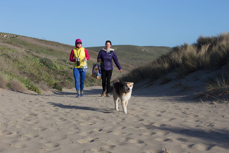
The short walk to the beach is mostly flat, but has a slightly steep, sandy part. There may be cows on the trail. 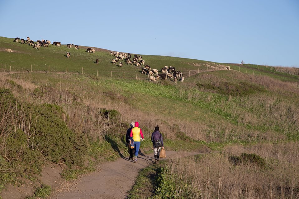
In 0.2 miles, you'll witness sand dune ecology before arriving at a beautiful beach. The intense surf and rocky cliffs make this a fun, dramatic little cove.
If it's windy, this won't be the ideal place for a relaxing picnic. We had to hide by a bluff to get some relief from the wind: 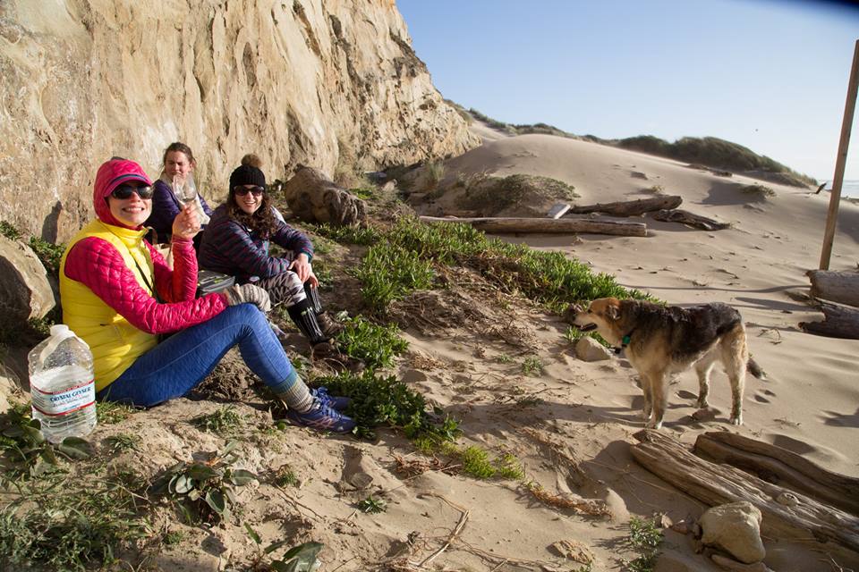
But even then, we got hit with occasional sand blasts. 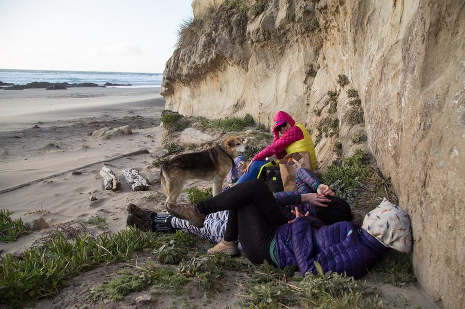
You should also check out: 1. The Earthquake Trail. Located near the picnic area at the Visitor's Center, this 0.7 mile educational loop will teach you all about the San Andreas fault line -- which is actually marked out with blue stakes along the trail. The trail is literally on the fault line. I first went here for a field trip while I was TAing a geology class. There is a very famous photo that's in, like, all of the geology textbooks. It's of a fence that was torn 16-feet apart during the 1906 earthquake -- a dramatic visualization of what happens when the earth moves. It's also handicap-accessible and dog-friendly. 
2. The $5 bin at the Point Reyes Surf Shop. I feel like I shouldn't even be telling you about this, because that is my $5 bin. But... there are definitely some incredible finds in the $5 (and, now, there's also a $10) bin at the Surf Shop at 11101 Highway 1, Point Reyes Station. If at all possible, I check it out every time I'm in the area. 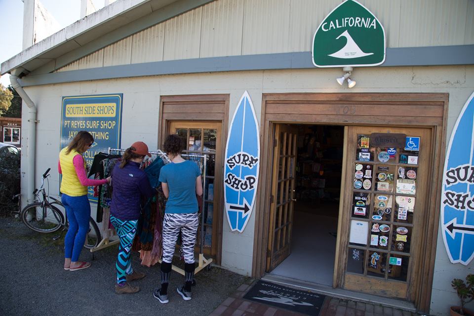
Enjoy your hike -- and feel free to share your tips, stories, and photos on my Facebook or Twitter!
0 Comments
Leave a Reply. |
About the Author

Eva is a content specialist with a passion for play, travel... and a little bit of girl power. Read more >
Want to support The Happy Talent? CLICK HERE!
Or Find me on Patreon!

What's Popular on The Happy Talent:


Trending in Dating and Relationships:


What's Popular in Science: 


Playfulness and Leisure Skills:


Popular in Psychology and Social Skills:


Categories
All
|
 RSS Feed